
| 产品 | 提前预定时间 | 取消政策 | 原价 | 优惠价 | ||
|---|---|---|---|---|---|---|
| 产品 | 提前预定时间 | 取消政策 | 原价 | 优惠价 | ||
|---|---|---|---|---|---|---|
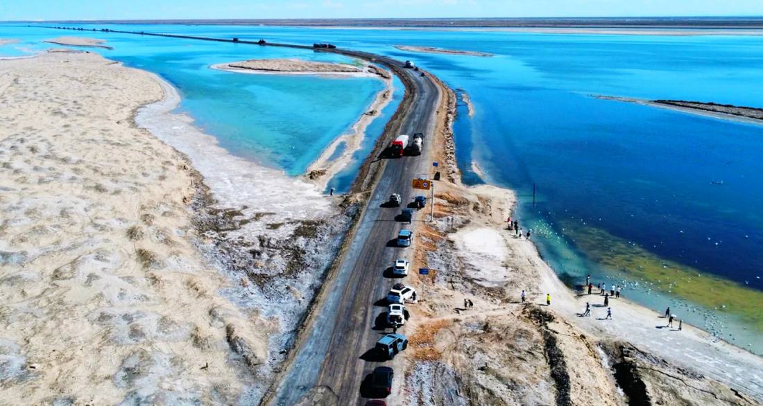
西台吉乃爾湖為免費開放的自然景觀,無需預訂或購買門票,可隨時駕車沿G315國道抵達湖邊觀景。注意事項包括:該區域無任何旅遊設施(如商店、衛生間),需自備飲水與食物;觀賞雙色湖的最佳時間為晴朗無風的上午,此時光線充足,湖面色彩對比最為明顯;務必注意交通安全,G315國道上大型貨車多、車速快,嚴禁在道路中央隨意停車,需將車輛完全停靠至路基外安全區域後再下車觀賞;湖邊部分為沼澤軟土,請勿過於靠近水邊,以防陷車或陷入泥潭;由於地處高原,請做好防曬、防風和防高反準備;全程遵守環保原則,帶走所有個人垃圾。
West Taijinaier Lake is a freely accessible natural landscape that requires no booking or entrance ticket; you can drive along the G315 National Highway to the lakeside for viewing at any time. Key considerations include: there are no tourist facilities (such as shops or restrooms) in the area, so bring your own drinking water and food; the best time to see the two-color lake is on a clear, windless morning when ample sunlight provides the most vivid contrast in water colors; traffic safety is essential—the G315 National Highway has many large trucks traveling at high speeds, so it is strictly prohibited to stop in the middle of the road; vehicles must be parked completely off the roadbed in a safe area before getting out to view the lake; parts of the lakeshore are marshy and soft, so avoid getting too close to the water's edge to prevent vehicle sinking or becoming stuck in mud; as the area is located on a plateau, prepare for sun protection, wind, and altitude sickness prevention; always follow environmental principles and take all personal trash with you.
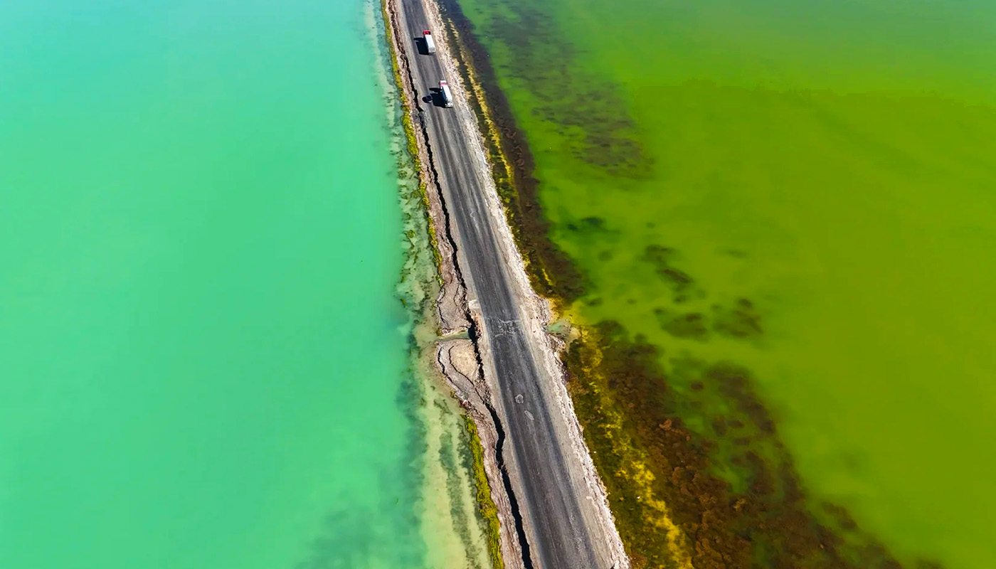
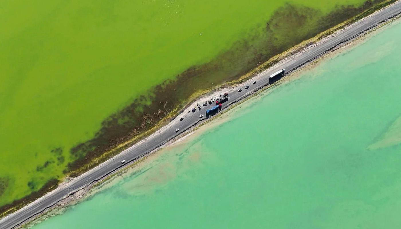
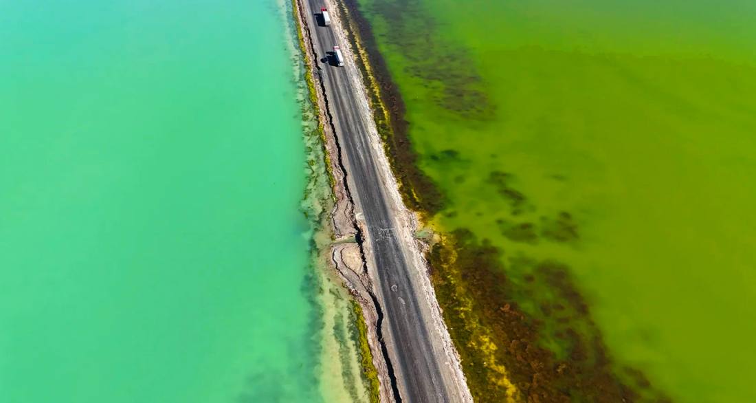
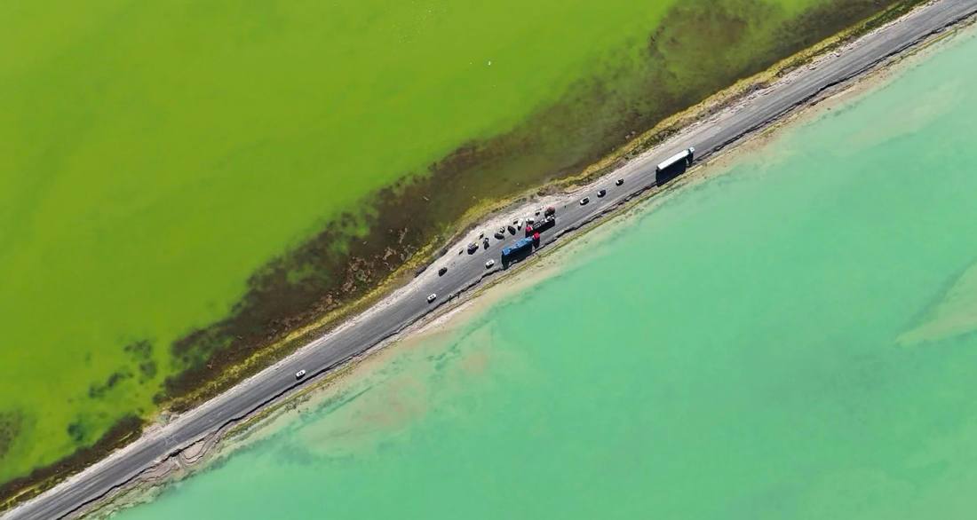
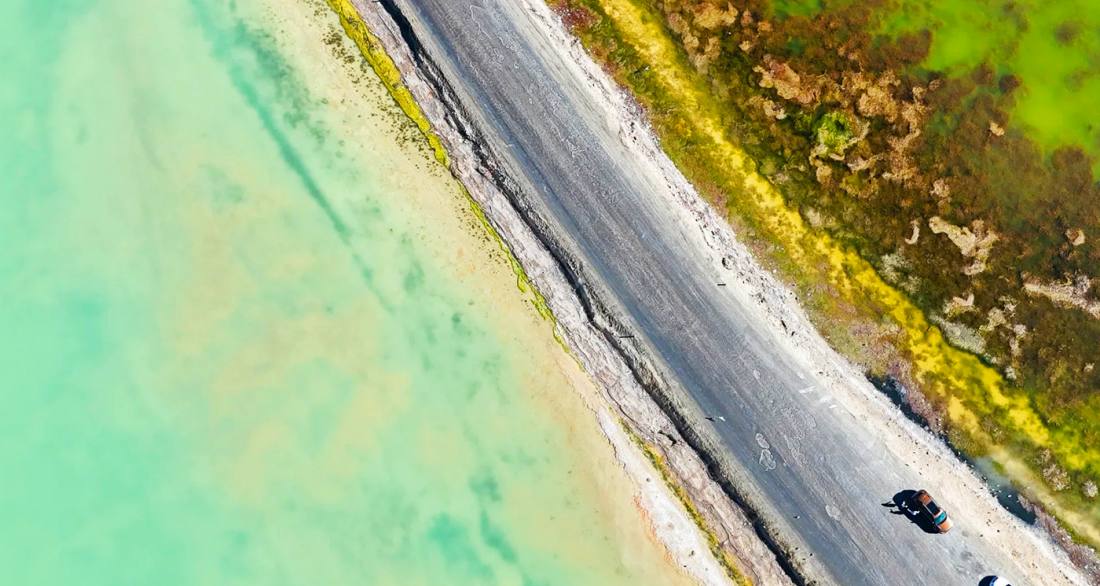
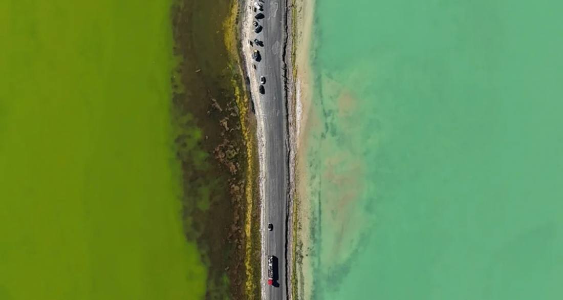
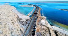
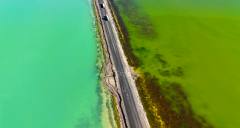
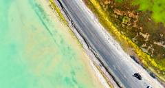
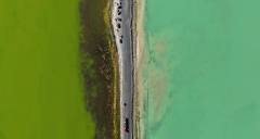
西台吉乃爾湖位於青海省海西蒙古族藏族自治州大柴旦鎮境內的柴達木盆地腹地,是G315國道穿行而過的一片硫酸鎂亞型鹽湖。其最獨特的景觀在於公路將湖面一分為二,因湖水礦物質濃度差異,一側因含銅離子較高呈現翠綠色,另一側因鹽分濃度高而折射出深藍色,形成鮮明的「雙色湖」奇觀,被遊客形象地稱為「鴛鴦火鍋」。湖面海拔二千六百七十八米,面積約八十二平方公里,湖水較淺,平均深度僅零點三至零點四米。這裡曾是東台吉乃爾湖的一部分,因湖泊退縮分離而成,如今與周邊烏素特水上雅丹等景點共同構成柴達木盆地的特色旅遊線路。夏季晴朗時,湖水在陽光下色彩分明,湖面偶有赤麻鴨等水鳥棲息,而湖底潔白的鹽結晶與遠處荒漠交織,形成一幅荒涼而瑰麗的高原畫卷。
West Taijinaier Lake is located in the heart of the Qaidam Basin within Da Qaidam Town, Haixi Mongol and Tibetan Autonomous Prefecture, Qinghai Province. It is a magnesium sulfate subtype salt lake through which the G315 National Highway passes. Its most distinctive feature is the highway that divides the lake into two halves, creating a striking "twin-color lake" phenomenon due to differences in mineral concentrations. One side appears emerald green because of its higher copper ion content, while the other side reflects a deep blue due to elevated salinity. The lake surface sits at an altitude of two thousand six hundred seventy-eight meters, covering an area of approximately eighty-two square kilometers, with a shallow average depth of just zero point three to zero point four meters. It was originally part of East Taijinaier Lake before separating due to lake recession and now, together with nearby attractions such as the Ussert Watery Yardang, forms a distinctive tourist route in the Qaidam Basin. On clear summer days, the lake water displays distinct colors under sunlight, occasionally hosting waterbirds like the ruddy shelduck, while the pure white salt crystals on the lakebed interweave with the distant desert to compose a desolate yet magnificent plateau landscape.