

| 产品 | 提前预定时间 | 取消政策 | 原价 | 优惠价 | ||
|---|---|---|---|---|---|---|
| 产品 | 提前预定时间 | 取消政策 | 原价 | 优惠价 | ||
|---|---|---|---|---|---|---|
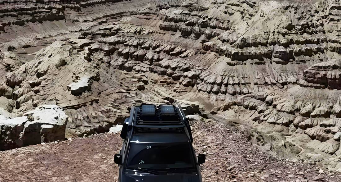
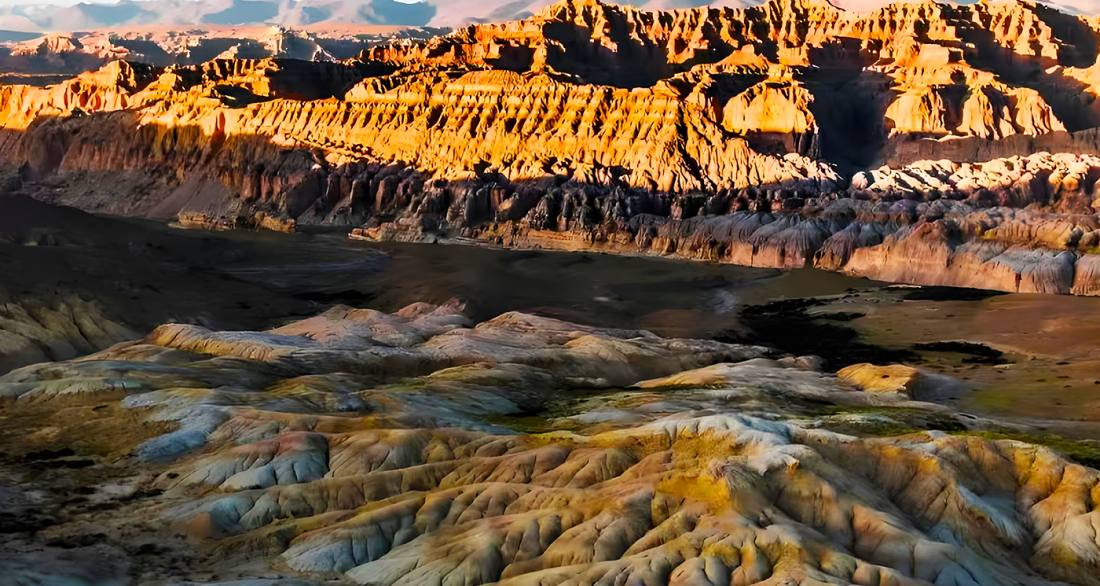
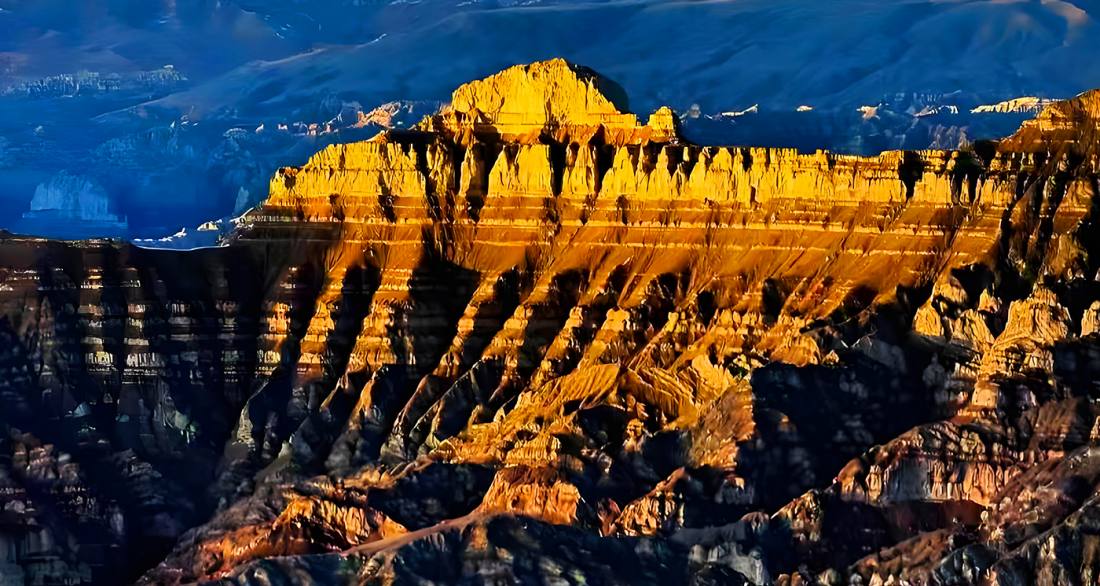
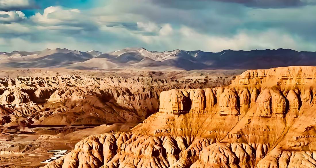
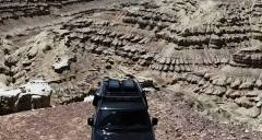
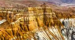
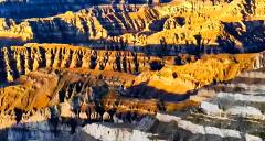
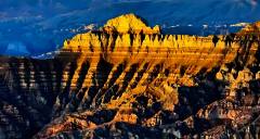
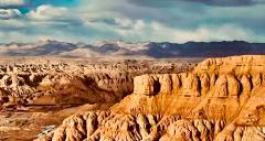
扎達土林(扎達土林國家地質公園)為國家級風景名勝區,核心區域開放時間為每日08:00-17:00,無需提前預約。景區位於西藏阿里地區札達縣境的象泉河谷,海拔約3750-4450米,前往時需攜帶有效證件購票進入。遊覽期間需特別注意高原反應防範,建議緩慢行動、備好氧氣和防寒衣物,並注意防曬補水。由於土林地質結構脆弱,遊客必須沿指定觀景步道行走,嚴禁攀爬、踩踏土林,禁止刻畫等破壞行為。最佳拍攝時間為清晨與傍晚,可欣賞土林在光影下的金黃與赭紅色彩。自駕前往需注意,部分路段為砂石路,建議駕駛越野車,並提前了解天氣與路況,雨季可能存在滑坡風險。離開時請帶走所有垃圾,共同保護這片珍貴的地質遺產。
The Zanda Clay Forest (Zanda National Geopark) is a National Scenic Area, with its core zone open daily from 08:00 to 17:00. No advance reservation is required. Located in the Xiangquan River Valley of Zanda County, Ngari Prefecture, Tibet, at an altitude of approximately 3,750–4,450 meters, visitors must present valid identification to purchase entry tickets. During the visit, it is essential to take precautions against altitude sickness: move slowly, carry oxygen supplies and warm clothing, and protect against sun exposure while staying hydrated. Due to the fragile geological structure of the clay forest, visitors must stay on designated viewing paths; climbing, trampling, or carving on the formations is strictly prohibited. The best time for photography is during the early morning or late afternoon, when the clay forest displays golden and reddish hues under the sunlight. For self-driving visitors, note that some sections of the road are gravel; a 4WD vehicle is recommended. Check weather and road conditions in advance, as landslides may occur during the rainy season. Please take all trash with you when leaving to help preserve this precious geological heritage.
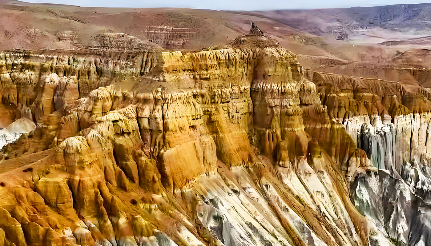
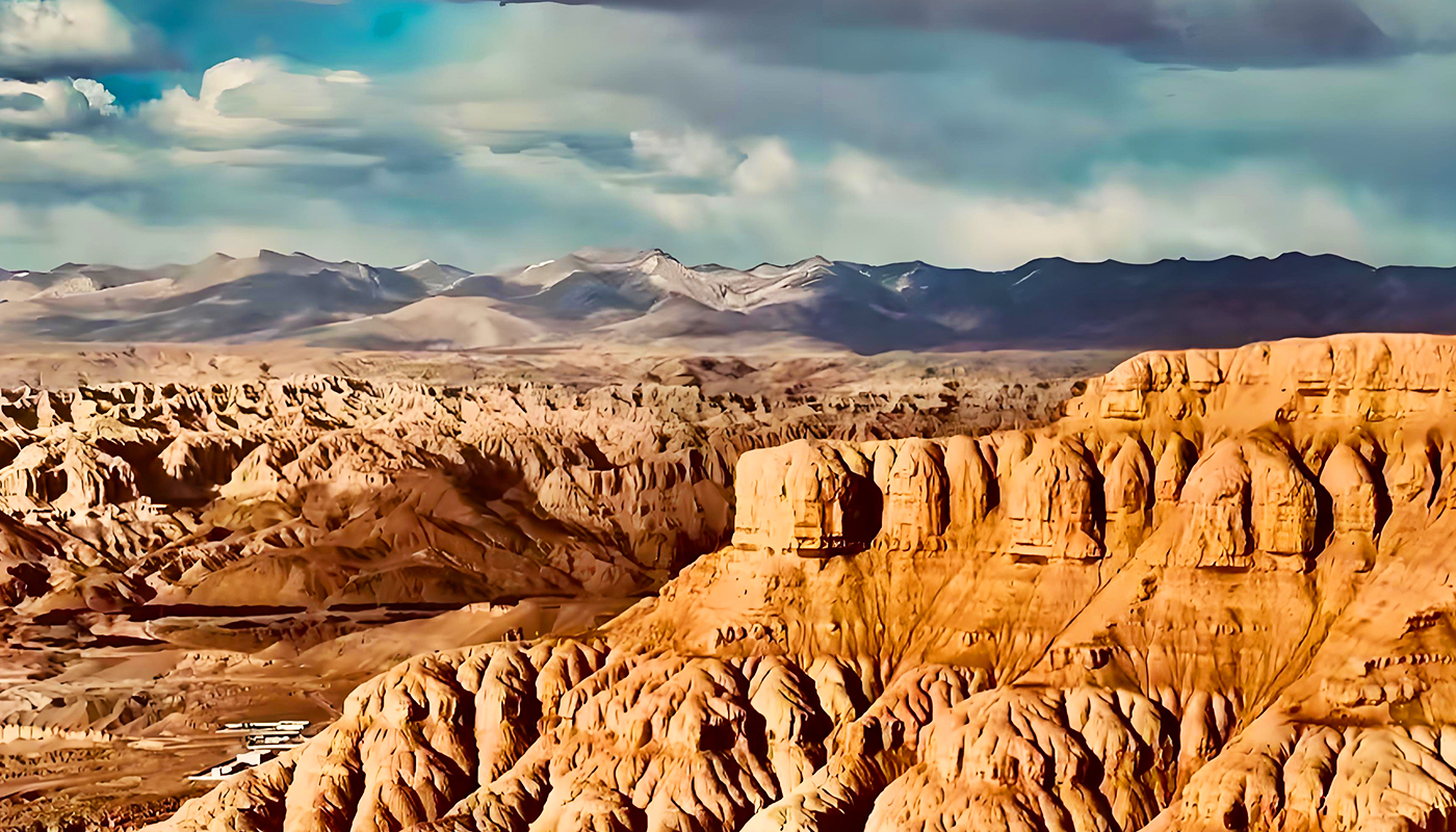
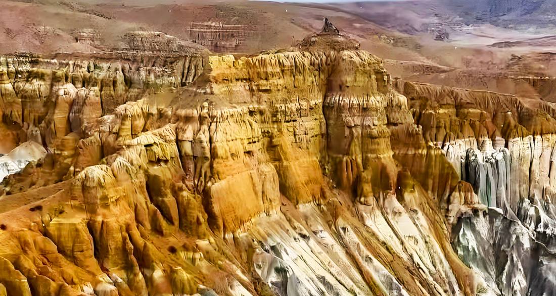
札達土林位於中國西藏阿里地區札達縣境內,是世界上最典型、分布面積最大的第三系地層風化形成的土林地貌,總面積約2464平方公里,核心區海拔在3750-4450米之間。這片壯觀的景觀是遠古大湖湖盆經數百萬年地質變遷,在喜馬拉雅造山運動作用下,湖底沉積層被象泉河(朗欽藏布)流水切割和風雨長期侵蝕而形成的特殊地貌。土林內形態千姿百態,有的像城堡、碉樓、佛塔,有的如萬馬奔騰或虔誠教徒靜坐,在高原迷幻光影的襯托下宛若神話世界。該區域不僅是國家級地質公園(2005年獲批),也是“土林-古格風景名勝區”(2016年獲批)的重要組成部分,包含古格王國遺址、托林寺等重要歷史遺跡。札達土林從北西到南東綿延約175公里,寬達45公里,是一片貌似北方的黃土高原,其岩層中還保存有貝殼、三趾馬等古生物化石,為研究高原古地理、古環境的變遷提供了重要證據。
Zanda Clay Forest is located in Zanda County, Ngari Prefecture, Tibet, China. It is the world's most typical and largest clay forest formed by the weathering of Tertiary strata, covering a total area of approximately 2,464 square kilometers, with its core area at an altitude of 3,750–4,450 meters. This spectacular landscape is the result of millions of years of geological transformation, where ancient lake basins, influenced by the Himalayan orogeny, were carved by the Xiangquan River (Langqên Zangbo) and eroded by wind and rain. The clay forest features diverse forms, resembling castles, watchtowers, pagodas, galloping horses, or devout worshippers in meditation, all accentuated by the mesmerizing plateau light, creating a mythical world. The area is not only a national geological park (approved in 2005) but also a key component of the "Clay Forest–Guge Scenic Area" (approved in 2016), encompassing important historical sites such as the ruins of the Guge Kingdom and the Toling Monastery. Stretching about 175 kilometers from northwest to southeast and spanning 45 kilometers in width, the clay forest resembles the Loess Plateau of northern China. Its rock layers contain fossils of shells, Hipparion, and other ancient organisms, providing important evidence for studying the paleogeography and paleoenvironmental changes of the plateau.