| 产品 | 提前预定时间 | 取消政策 | 原价 | 优惠价 | ||
|---|---|---|---|---|---|---|
| 产品 | 提前预定时间 | 取消政策 | 原价 | 优惠价 | ||
|---|---|---|---|---|---|---|
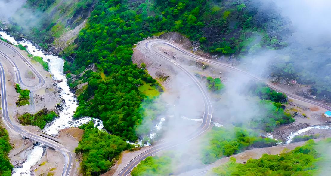
陳塘溝為國家AAA級景區,目前門票通常為現場購買,無需線上預約。由於地處中尼邊境地區,前往前必須提前在戶籍地或日喀則市辦理邊境通行證。最佳遊覽期為5月至10月,但需注意雨季(7-8月)道路易發塌方。景區內信號較弱,建議提前下載離線地圖,並自備足夠現金。海拔從約2000公尺至5500公尺,溫差大,需準備保暖衣物、防曬用品及抗高反藥物。遊覽時請遵守環保規定,帶走所有垃圾,切勿擅自跨越國界,並尊重夏爾巴人獨特的風俗習慣(如徵得同意後再拍照)。自駕遊客務必確認車輛狀況良好,建議選擇底盤較高的車型。
Chengtang Valley is a National AAA-level scenic area. Tickets are generally purchased on-site, and no online reservation is required. As it is located in the China-Nepal border area, it is mandatory to obtain a Border Permit in advance, either in your registered residence city or in Shigatse. The best time to visit is from May to October, but note that roads are prone to landslides during the rainy season (July-August). Mobile signals are weak in the area, so it is advised to download offline maps in advance and carry sufficient cash. The altitude ranges from about 2,000 to 5,500 meters, with significant temperature variations, so prepare warm clothing, sun protection, and altitude sickness medication. While visiting, adhere to environmental regulations, take all trash with you, do not cross the national border, and respect the unique customs of the Sherpa people (e.g., ask for permission before taking photos). Self-driving visitors must ensure their vehicles are in good condition, preferably with high ground clearance.
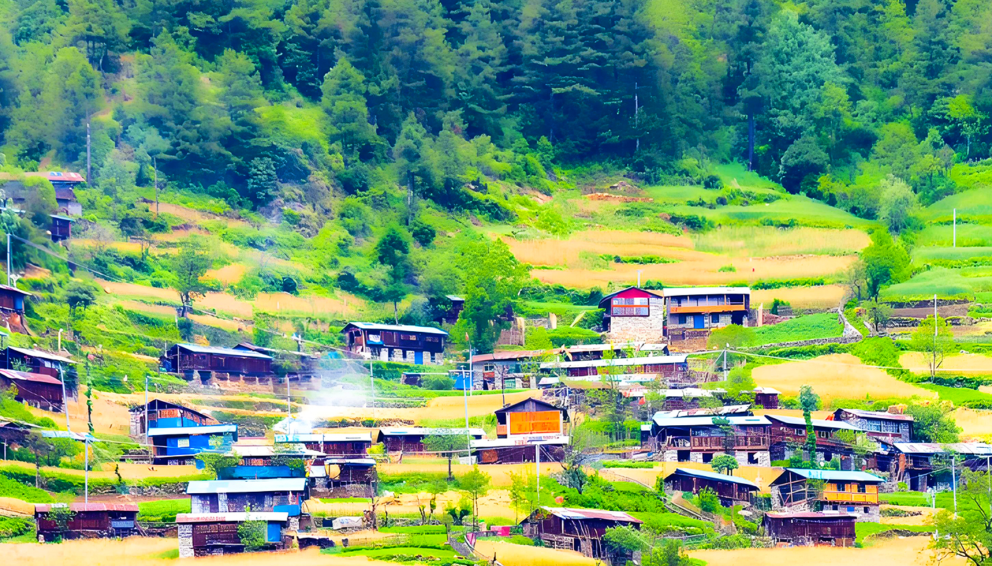
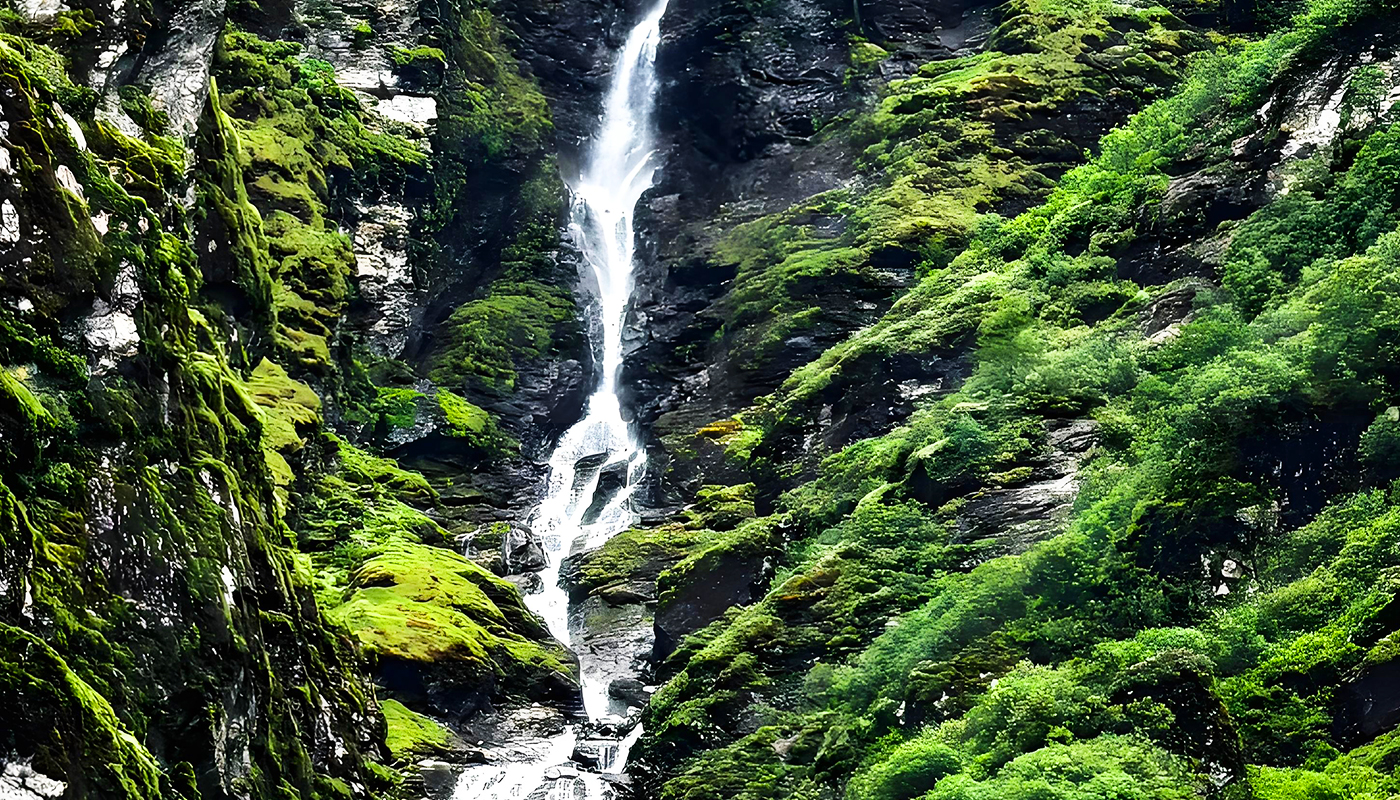
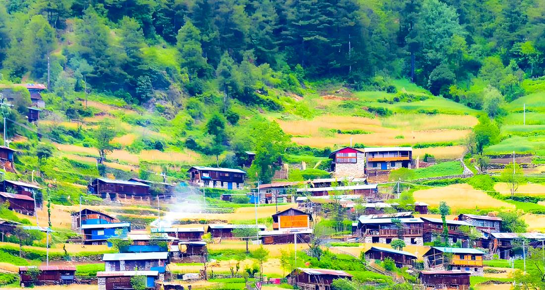
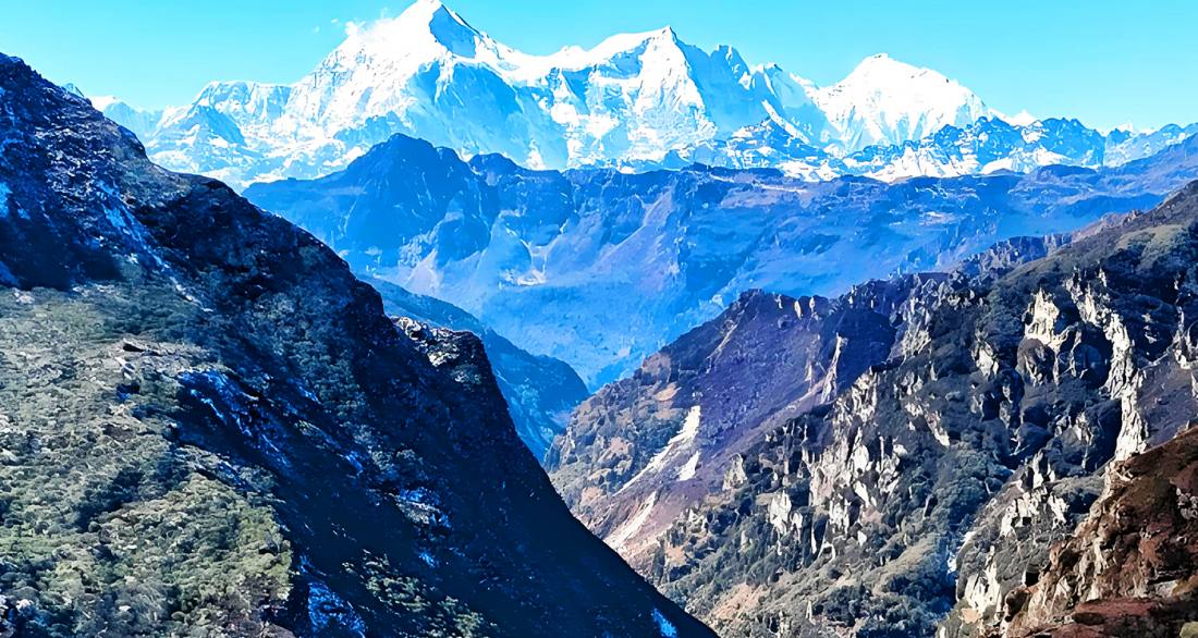
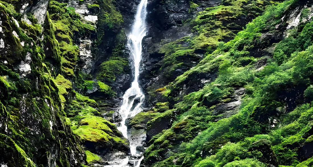
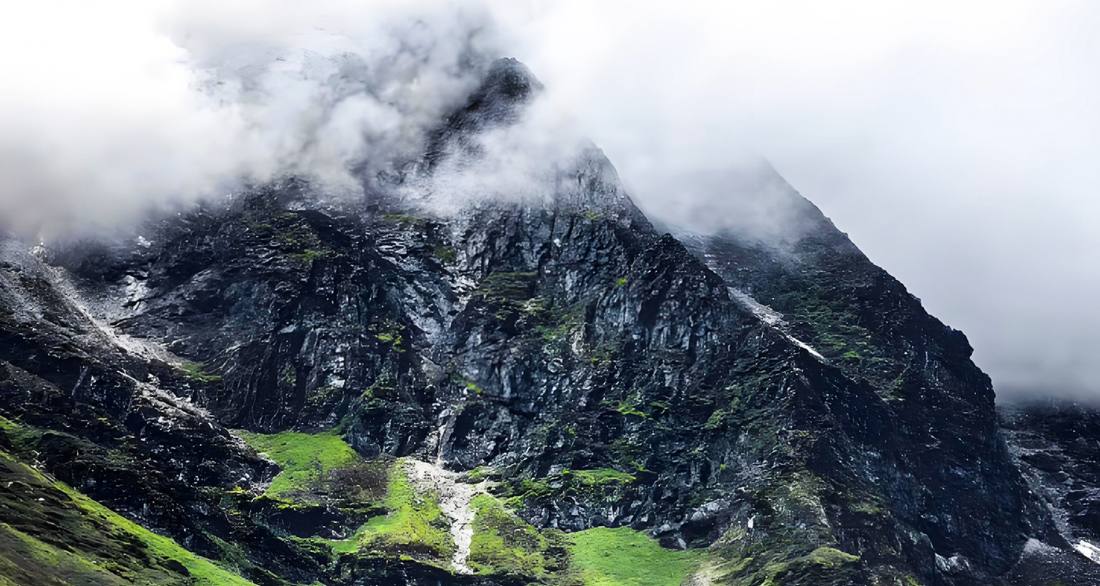
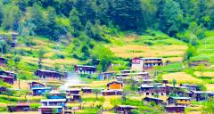
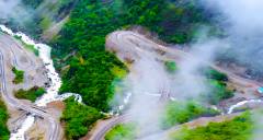
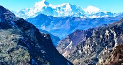
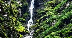
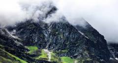
陳塘溝位於西藏自治區日喀則市定結縣西南部,是喜馬拉雅山脈五大名溝之一,素有「中國最後一座陸路孤島」之稱。這裏平均海拔約2040米,屬亞熱帶季風氣候,印度洋暖濕氣流造就了「一山分四季,十里不同天」的垂直景觀,從雪山冰川到原始森林(覆蓋率達98%),瀑布湖泊交相輝映。陳塘溝是珠峰自然保護區的核心地帶,不僅孕育了羚羊、雪豹等珍稀動物,更是中國夏爾巴人的主要聚居地,夏爾巴人口占當地人口的八成以上。其名稱源於修建薩迦寺時運輸木材的歷史(「陳」意運輸,「塘」意道路),當地保留着獨特的夏爾巴文化,如雞爪谷酒釀製、彩色帽飾、傳統歌舞(已列入非物質文化遺產)以及原始苯教信仰。儘管2017年公路修通後結束了完全依賴人背畜馱的歷史,但陡峭地形與邊境位置(東南與尼泊爾接壤)仍使其充滿神秘色彩,是探討自然奇觀與人文遺產的秘境。
Chengtang Valley, located in the southwest of Dingjie County, Shigatse, Tibet, is one of the five famous valleys of the Himalayas and has been called "China's Last Land Island". With an average altitude of about 2,040 meters and a subtropical monsoon climate, it features a striking vertical landscape—from snow-capped mountains and glaciers to dense primeval forests (98% forest coverage)—created by Indian Ocean moisture, resulting in "four seasons across one mountain, different weather every ten miles". As a core area of the Everest Nature Reserve, it is rich in biodiversity, including rare animals like the antelope and snow leopard, and is a primary settlement for China's Sherpa people, who make up over 80% of the local population. The valley's name derives from its history as a timber transport route ("Chen" means transport, "Tang" means road) for the construction of Sakya Monastery. The Sherpa community preserves unique cultural traditions, such as brewing finger millet wine, wearing colorful symbolic hats, performing traditional songs and dances (listed as intangible cultural heritage), and practicing原始苯教 (Bön) beliefs. Although a road was built in 2017, ending reliance on human porters and animal caravans, the steep terrain and border with Nepal to the southeast maintain its aura as a mysterious destination blending natural wonders and living cultural heritage.